Bathymetry and Coastlines for the gulf of mexico


Bathymetric data collections

Access the data
Warning: Do not use the data provided in this site for navigation.
This website is best viewed in Firefox/Safari/Google Chrome
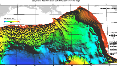
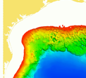
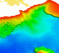
The site includes currently available bathymetric data in the Gulf of Mexico.
Entire region
-
•SRTM30PLUS - 30 arc second SRTM Land topography with measure and estimated seafloor topography in the Gulf of Mexico. The data was based on SRTM30_PLUS V6.0
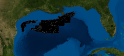
Northern Gulf of Mexico (US)
-
•Multibeam Bathymetry (MB) - The georeferenced multi-beam full soundings data
-
➡ ArcInfo point coverage format (MB-Pts)
-
➡ 50 m gridded data in XYZ format (MB-GRID)
-
➡ 50 m gridded data in UTM zone (MB-UTM)
-
•Others - Bathymetry related data in shapefile format (Shapefiles)
