Access the data

Shoreline
Disclaimer: All the data have been carefully prepared. Texas Sea Grant College Program, Texas A&M University, or Geoscience Earth & Marine Services, Inc., (GEMS) assumes no responsibility or liabilities for any reliance on the information presented.
Access the Data: SRTM30PLUS CRM MB-Pts MB-GRID MB-UTM Shapefiles Shoreline Links
NOAA’s medium resolution shoreline: Gulf of Mexico - GIS File Download site
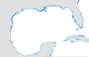
Global Self-consistent Hierarchical High-resolution Shoreline
(GSHHS) - Gulf of Mexico
Detailed description
Data provided here is a shapefile derived from full resolution GSHHS shoreline. It is cropped in the specific extent as shown in figure.
(GSHHS_f_GOM.zip) (2.2 MB)