Access the data

bathymetry (multi-beam soundings points coverage)
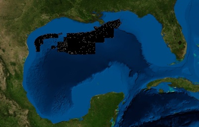
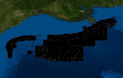
Lat/Long/Depth ArcGIS Points coverage archived file (503.4MB)
Download: soundings.zip
This archive contains the georeferenced multibeam full soundings. The actual point data file is about 1.76 GB in size and has been compressed with the name "soundings_xyz.tar.gz".
These full soundings (over 31 million point data) are in longitude, latitude, and depth (in meters). The datum is NAD83. The data file is in ArcInfo point coverage format. The point data name is "soundings". “Info” directory is a corresponding directory for the ArcInfo coverage
Disclaimer: All the data have been carefully prepared. Texas Sea Grant College Program, Texas A&M University, or Geoscience Earth & Marine Services, Inc., (GEMS) assumes no responsibility or liabilities for any reliance on the information presented.
Access the Data: SRTM30PLUS CRM MB-Pts MB-GRID MB-UTM Shapefiles Shoreline Links