Access the data

bathymetry (Multi-beam Grid data (x,y,z) in utm coordinate system)
UTM Easting/Northing/Depth - 300 m resolution - ASCII files (.utm) (28.6 MB) Download: 300.tar.gz
This archive contains the georeferenced multibeam data in UTM coordinate system.
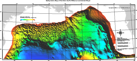
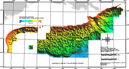
These grid data are in UTM easting, northing, and depth (in meters). The datum is NAD83. The grids are either 300 m (for the merged multibeam and digitized seismic data) or 50 m (for the multibeam data). The data is grouped into 2° by 1° area for the 300m grid and 1° by1° area for the 50m grid.
These files provided are compressed files that contain multiple .utm files. The .utm file is a grid x,y,z file: You would be able to view a file via notepad, wordpad, excel etc.
In order to use those files in ArcGIS environment, please convert the file extensions to your favorite file type (ex. .txt)
-
-300m gridded data derived from the merged multibeam and digitized seismic.
- 50m gridded multibeam data in the central part of the Gulf of Mexico. It covers from about 87° to 94°W.
- 50m gridded multibeam data in the western part of the Gulf of Mexico. It covers from about 93.7°W to 97.3°W.

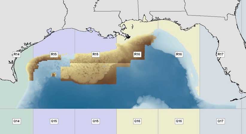
Data for each UTM 14 - 17 Zone
“UTM##_ngdc” contains a 300m grid data directory "ngdc" in the UTM ## zone (blue color)
“UTM##_west/alam/central” contains a 50m grid data directory "west/alam/central". (brown color)
Under each sub-directory, the file name has a format of "starting_longitude ending_longitude starting_latitude ending_latitude.utm.gz".
UTM15_alam.zip (1.4 MB)
UTM15_central.zip (166.4 MB)
UTM15_ngdc.zip (19 MB)
UTM15_west.zip (17.9 MB)
(479 KB)
Access the Data: SRTM30PLUS CRM MB-Pts MB-GRID MB-UTM Shapefiles Shorelines Shoreline Links
Disclaimer: All the data have been carefully prepared. Texas Sea Grant College Program, Texas A&M University, or Geoscience Earth & Marine Services, Inc., (GEMS) assumes no responsibility or liabilities for any reliance on the information presented.
Access the Data: SRTM30PLUS CRM MB-Pts MB-GRID MB-UTM Shapefiles Shoreline Links
UTM Easting/Northing/Depth - 50 m resolution - ASCII files (.utm) (Central areas) (148.9 MB) DL: central.tar.gz
UTM Easting/Northing/Depth - 50 m resolution - ASCII files (.utm) (Western areas) (17.3 MB) DL: west.tar.gz